


Naha City Disaster Evacuation Sites 災害 (さいがい) -《台風 (たいふう) や 津波(つなみ) など》のとき 逃(に)げる ところ
ページ番号1008499 更新日 令和7年12月24日
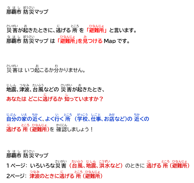
Map of Disaster Evacuation Sites / 避難所(ひなんじょ)《災害(さいがい)- 台風(たいふう) や 津波(つなみ)などの とき 逃(に)げる ところ》のMAP
Naha City Disaster Prevention Map
The “Naha City Disaster Prevention MAP” is a map that shows evacuation sites in the event of a disaster.
We never know when a natural disaster might strike us.
Do you know where to evacuate in the event of a disaster like an earthquake,
tsunami, typhoon, etc.?
Check “Naha City Disaster Prevention Map” to find evacuation sites in the event of disaster!
Especially near your home and the places you often visit - school, work, shops, etc.
Naha City Disaster Prevention Map
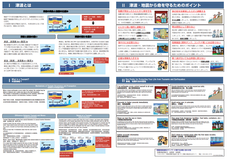
Page 1 shows evacuation sites for general disaster - typhoon, earthquake, flood, etc.
Page 2 shows tsunami emergency evacuation sites.
Naha City Disaster Prevention Map 2025 / 那覇市 防災(なはし ぼうさい)マップ 2025
Naha City Disaster Prevention Map 2025
那覇市 防災(なはし ぼうさい)マップ 2025
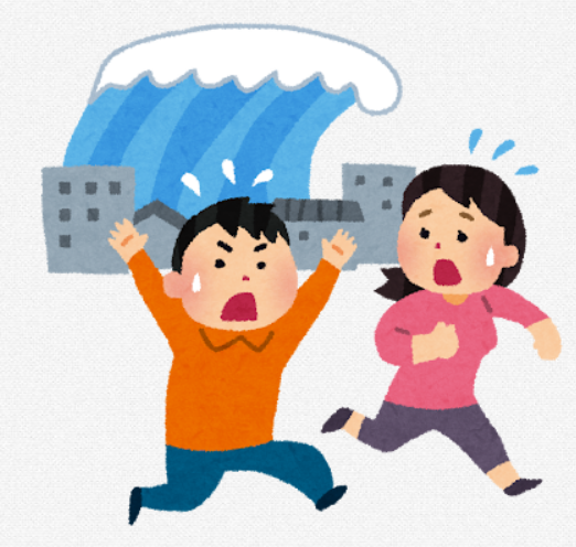
Tsunami/津波(つなみ)
Tsunami Information / 津波(つなみ)の はなし
You can see it bigger and clearer by clicking the link below.
下(した) のリンクを クリックすると、もっと 大(おお)きく、はっきり 見(み)えます。
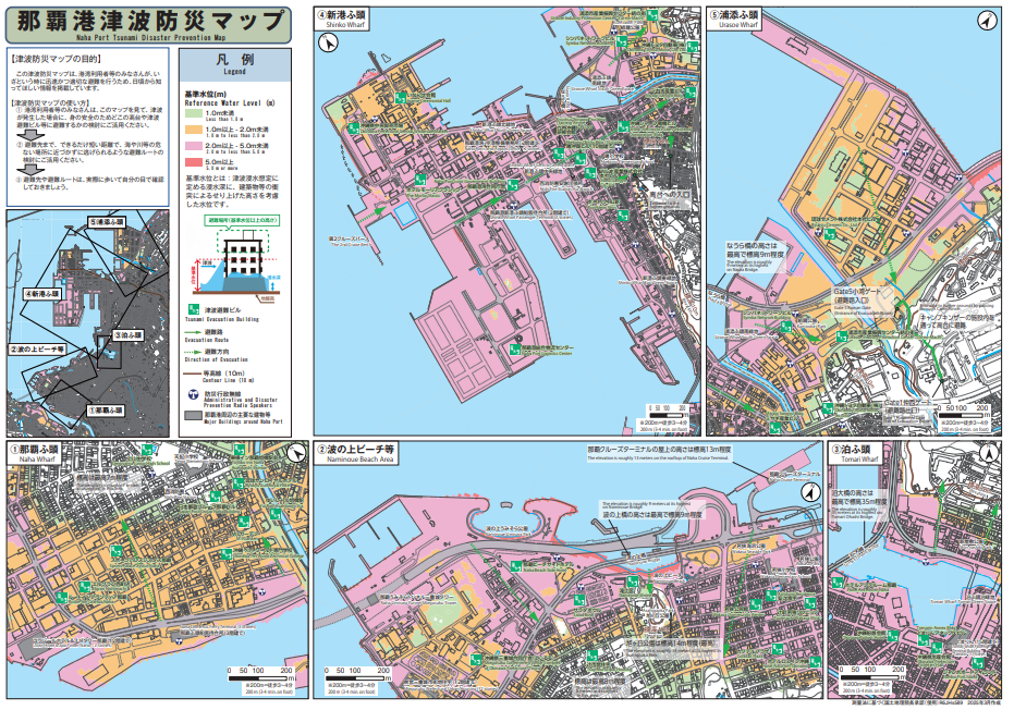
Tsunami Evacuation Sites near Naha Port / 津波(つなみ)のとき 逃(に)げるところ: 那覇 港(なはこう) の 近(ちか)く

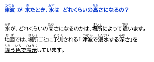
How high might the water rise during a flood or tsunami?
The water level is different at each area.
The map uses different colors to show the predicted tsunami inundation for each area.
Evacuate to High Ground !/ 高(たか)い ところに 逃(に)げる!
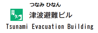
津波(つなみ)で逃(に)げる(避難(ひなん)する)ビル の マーク
Tsunami
Make sure to check: Naha Port Tsunami Disaster Prevention Map to find tsunami emergency evacuation
buildings, such as stations, buildings and hotels, so you can evacuate to these places during a tsunami or a flood.
那覇港(なはこう)津波(つなみ)防災(ぼうさい) マップを見(み)て、津波(つなみ)緊急(きんきゅう)一時避難施設(いちじひなんしせつ)(津波(つなみ)が来(き)たときに逃(に)げるところ:駅(えき)・ビル(びる)・ホテル(ほてる)など)を確認しましょう!
Tsunami Evacuation Sites near Naha Port
なはこう の ちかくの にげるところ
Naha Port Authority / 那覇港 管理組合(なはこう かんりくみあい)
Okinawa Disaster Prevention Information Portal /沖縄 防災 情報(おきなわ ぼうさい じょうほう) ポータル
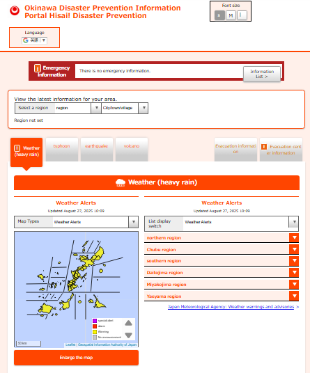
Visit the link below/ 下(した)のリンクをクリック 【にほんご/English/Korean/中国語(簡体・繁体)】
-
Okinawa Disaster Prevention Information Portal /沖縄 防災 情報(おきなわ ぼうさい じょうほう)ポータル ハイサハイサイ!防災で~びる#(外部リンク)

このページに関するお問い合わせ
市民文化部 市民生活安全課 市民生活相談グループ
〒900-8585 沖縄県那覇市泉崎1丁目1番1号(市庁舎1階)
電話:098-862-9955
ファクス:098-861-3769